
Travel
North Face of Mount Everest: A Stark, Remote Challenge
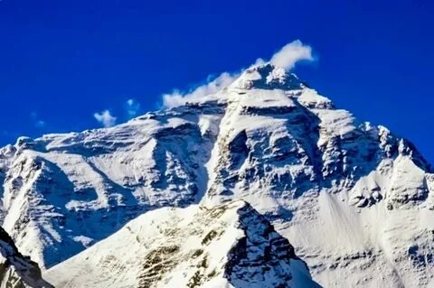
Climbing the north face of Mount Everest reveals a world of high-altitude danger and historic achievement. This iconic route—on the Tibetan side—draws fewer climbers but demands more skill. Let’s explore its terrain, key features, and what makes it uniquely dramatic.
What Is the North Face of Mount Everest?
The north face of Mount Everest is the mountain’s northern side, accessible via Tibet. This remote region is known for steep couloirs, icy ridges, and harsh conditions. It’s a place where “a simple slip would mean death.”
Geography & Key Route Features
Climbers embark from Rongbuk Base Camp (~5,150 m). The route advances via the North Col—a glacial ridge connecting Everest and Changtse—and follows the Northeast Ridge.
Along the way are the infamous Three Steps—rock pinnacles near the summit at ~8,560 m, 8,610 m, and 8,710 m. The Second Step is nearly vertical and requires a ladder.
Two steep gullies—the Hornbein Couloir and Norton Couloir—flank the face. Hornbein, with inclines ranging from 47° to 60°, is especially treacherous.
History: Mysteries and First Ascents
In 1921, Mallory, Wheeler, and Bullock first reached the North Col. Mallory later returned with Sandy Irvine in 1924, vanishing near the summit. Mallory’s body was found in 1999.
The first confirmed summit via the northeast ridge from Tibet occurred on May 25, 1960, when Chinese climbers Wang Fuzhou, Qu Yinhua, and Gongbu reached the top.
The Hornbein Couloir was first climbed in 1963 by Tom Hornbein and Willi Unsoeld, who ascended the West Ridge before traversing to the north side.
Everest North Col: Access & Logistics
The Everest North Col is a high pass at ~7,000 m connecting Everest and Changtse. It was first reached in 1921 and serves as a staging area for climbers from Tibet.
Rongbuk Base Camp is accessed by road via Tingri and the Friendship Highway. A paved road built in 2015 made access far easier compared to Nepal’s approach.
Why Climb the North Face?
Advantages:
- Avoids the dangerous Khumbu Icefall of the south route.
- Fewer crowds and less congestion.
- Lower permit fees, though overall logistics can cost more.
Drawbacks:
- Harsh weather: fierce winds and extreme cold. Summit winds often exceed 100 km/h; temps near –30°C, with wind chills around –50°C.
- Technical terrain: the steep couloirs, three Steps, seracs, and icy slopes demand high skills.
- Longer summit day (16–20 hrs) and lower rescue support.
- Slightly lower success rate (~55% vs. ~65% on south route).
Climbing Challenges at a Glance
Comparing North vs. South Routes
The south (Nepal) route is more popular and structured. It has better support, helicopter evacuation, and more trekking amenities.
But it also includes hazards like the Khumbu Icefall and traffic jams near the Hillary Step. Overcrowding has even led to dangerous delays.
The north route offers solitude and fewer icefall dangers—but trades them for technical difficulty and exposure to climate extremities.
Conclusion
The north face of Mount Everest defines high‑altitude ambition. Its rugged landscapes, technical hazards, and chilling beauty make it both alluring and fearsome. From Mallory’s mysterious disappearance to modern expeditions via the Hornbein Couloir—this route encapsulates the harshest side of Everest.
For skilled climbers seeking a serious challenge beyond crowds and conventions, the north face remains the ultimate test.
FAQs
1. What is the North Col on Everest?
The North Col is a glacial pass (~7,000 m) between Everest and Changtse. It’s the main launch point for climbs via the north route. Mallory and team first reached it in 1921.
2. How does the Tibet climbing route compare to Nepal’s?
Tibet offers fewer climbers and no Khumbu Icefall, but colder weather, stricter permits, and longer summit days. Nepal’s route is more supported and socially immersive.
3. Can you trek to Everest Base Camp north?
Yes. Rongbuk Base Camp (~5,150 m) is reachable by vehicle via a paved road. It’s far easier than trekking to the south camp.
4. Why is the north face more dangerous?
Extreme wind, freezing cold, steep and technical terrain, high fatalities, and limited evacuation options make it more perilous.
5. Who first summited Everest via the north face?
On May 25, 1960, Chinese climbers Wang Fuzhou, Qu Yinhua, and Gongbu became the first to reach the summit via the north route.

Introduction
Veneajelu—literally “boat ride” in Finnish—is more than a simple cruise. This relaxing and cultural experience blends exploration, tradition, and nature’s beauty. Whether you’re gliding across a lake or exploring islands, veneajelu promises serenity and wonder.
1. What Is Veneajelu?
Veneajelu, from vene (boat) and ajelu (ride), means “boat trip” in Finnish. It describes a leisurely or cultural journey across lakes, rivers, or coastal waters for recreation—not just travel.
2. A Cultural Tradition in Finland
Boats were once vital tools for fishing, trade, and connecting lakeside communities. Over time, veneajelu evolved into a cherished leisure ritual for many Finns. Today, families, locals, and tourists embrace the tradition for its simplicity and connection to Finnish life.
3. Types of Veneajelu: From Risteily to Järvimatka
Veneajelu takes various forms, fitting all moods and activities:
- Risteily (cruise): Organized boat rides with commentary, snacks, or sightseeing, often in cities like Helsinki.
- Saariretki (island trip): Visits to islands including stops for picnics or exploration, common in archipelago regions.
- Maisemaristeily (scenic cruise): Rides focused on views—forests, lakes, cityscapes—that slow down time and frame natural beauty.
- Järvimatka (lake trip): Riding across Finland’s vast lakes, such as Lake Saimaa or Päijänne, offering peace and wide horizons.
- Vesibussi (water bus): While not always mentioned in top content, vesibussi refers to water‑based public transport often used around island areas—related and useful for context.
4. Best Places for Veneajelu
a. Lake Saimaa & Inland Waters
Saimaa, Finland’s largest lake, offers intricate waterways, clear water, and chances to spot the rare Saimaa ringed seal—a perfect järvimatka.
b. Helsinki Archipelago & Coastal Rides
Around Helsinki, a maisemaristeily brings together urban and natural scenery, passing Suomenlinna, historic islands, and the city’s skyline.
c. Åland & Turku Archipelagos
These regions are prime for saariretki adventures—quiet harbors, Nordic culture, and easy island hopping make them a favorite.
5. What Makes Veneajelu So Appealing?
- Nature connection: Peaceful water, forests, open skies—a breather for city souls.
- Relaxation & adventure: From still rowboat rides to guided cruises, it suits both calm and curious minds.
- Cultural value: A summer staple in Finnish life, veneajelu carries family memories, simplicity, and tradition.
6. Practical Tips for a Smooth Riding Experience
- Safety first: Always wear life jackets, check weather, bring a phone or map, especially with children.
- Gear essentials: Sunscreen, snacks, water, and camera—or waterproof case. Planning makes for a better experience.
- Eco‑friendly choices: Opt for rowing or electric motors, avoid trashing lakes, and protect natural zones.
7. Benefits of a Veneajelu
- Mental calm: Light rocking water, wide nature, and quiet waters reduce stress and boost mood.
- Physical activity: Rowing or sailing adds gentle exercise and fresh-air wellness.
- Bonding time: Friends, couples, and families share simple joys—picnics, island stops, even fishing trips.
Conclusion
Veneajelu—Finland’s boat ride tradition—is both simple and rich. Whether drifting across a järvimatka, touring islands on a saariretki, or soaking in views during a maisemaristeily, each ride offers peace, cultural ties, and nature’s touch. With safety, respect for nature, and light planning, veneajelu becomes a memory—one that floats long after the trip ends.
FAQs
1. What does “veneajelu” mean?
It means “boat ride” in Finnish, embodying leisurely boating across lakes, rivers, or seas.
2. Do I need a license for veneajelu?
Small boats usually require no license. Larger motorboats might, depending on Finnish regulations.
3. Best time for a veneajelu?
Summer is peak time thanks to warmth and daylight. Spring and autumn offer scenic calm. Winter means ice, so not for boating.
4. Where to go for veneajelu near Helsinki?
The Helsinki archipelago is top. Short cruises go from city sights to peaceful islands like Suomenlinna.
5. What do I bring on a veneajelu?
Essential gear includes life jackets, water, snacks, sunscreen, and a camera—or waterproof case.
Introduction
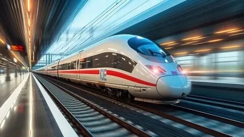
The Intercity Express Programme launched a new era of high-speed trains in the UK. Built by Hitachi Rail, it revolutionized the UK rail modernization efforts on key lines like the Great Western Main Line using bi‑mode technology. This journalist-style overview explains its scope, impact, and future.
1. What Is the Intercity Express Programme?
The Intercity Express Programme (IEP) was an initiative by the UK’s Department for Transport to replace aging InterCity 125 and 225 trains. It aimed to boost capacity, reliability, and environmental performance using modern high-speed trains built under a long-term investment model.
2. Project Scope and Goals
IEP’s scale is immense—arguably the largest rolling-stock investment in over 30 years. The project involved design, manufacture, financing, and maintenance of new trains over ~27.5 years.
It covered both the Great Western Main Line and the East Coast Main Line, ensuring modern, reliable service across long-distance routes.
3. Who Built It? Agility Trains & Hitachi Rail
The Agility Trains consortium—featuring Hitachi Rail, Axa UK, and GLIL Infrastructure—landed the contract around 2009 and finalized a £4.5 billion deal in 2012.
Hitachi built a factory in Newton Aycliffe, County Durham, to assemble the new trains using Japanese-built bodyshells but UK-based outfitting.
4. The Fleet: Advanced Bi-Mode Technology
IEP trains (Classes 800, 801, 802) are part of Hitachi’s AT300 family. The flagship Class 800 bi‑mode units can switch seamlessly between electric and diesel power—ideal across mixed electrified and non-electrified routes.
They deliver higher speeds (up to 125–140 mph), more seats, modern interiors, and better environmental performance.
5. Deployment on Key UK Routes
- Great Western Main Line (GWR): 93 IEP trains added regular seats and reliability.
- East Coast Main Line (LNER): 65 trains branded as “Azuma” by LNER.
Other operators like TransPennine Express and Hull Trains also received IEP sets.
6. Overcoming Electrification Delays
Delays in railway electrification pushed GWR’s pure electric units to be converted into bi‑mode configuration, ensuring continued service despite infrastructure slowdowns.
7. National and Industrial Impact
The project brought manufacturing back to northern England, creating engineering jobs and skills development—especially evident in Newton Aycliffe’s facility opening and apprenticeships. It also modernized UK rail infrastructure and maintenance, with depots built at strategic locations like Doncaster, Stoke Gifford, and Swansea.
8. Performance and Reliability Gains
Split electric/bi‑mode capacity has improved reliability—it now outperforms older fleets by up to 2.3 times.
Conclusion
The Intercity Express Programme stands as a milestone in UK rail modernization. With Hitachi Rail at the helm under the Agility Trains consortium, it delivered cutting-edge high-speed trains using pioneering bi-mode technology. Serving major routes like the Great Western Main Line, IEP transformed capacity, reliability, and passenger experience, while nurturing British manufacturing and engineering talent.
Frequently Asked Questions
1. What are bi-mode trains?
Bi‑mode trains, such as Class 800, can run on overhead electric power or switch to diesel engines. This flexibility tackles gaps in electrification.
2. Where are IEP trains assembled?
Hitachi’s Newton Aycliffe facility in County Durham assembles the trains, combining bodyshells from Japan with UK outfitting.
3. Which rail lines use Intercity Express Trains?
They serve the Great Western Main Line, East Coast Main Line, and are used by operators like GWR, LNER, TransPennine Express, and Hull Trains.
4. Why was electrification a challenge, and how was it handled?
Delays in electrifying the rail network forced some electric IEP units into bi‑mode operation to ensure service continuity.
5. What’s the economic benefit of IEP?
It restored train manufacturing to the UK, provided jobs, modernized infrastructure, and boosted reliability—benefiting passengers and local economies.
Introduction
“Hoogwaardig openbaar vervoer” means high‑quality public transport. It’s fast, reliable, and comfy. This type of public transport offers an attractive alternative to cars in cities.
What Is Hoogwaardig Openbaar Vervoer?
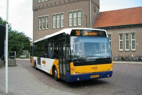
High‑quality public transport (HOV) includes fast, frequent, and reliable services with good comfort and real‑time info for users. It may run on rails or roads. Light Rail often forms part of HOV. Frequent stops and strong branding make the service feel like a product to sell to riders.
Why It Works Better Than Cars
HOV competes with cars because it’s frequent (every few minutes), fast, and reliable. It runs early and late, even on weekends. It often has lanes or signal priority to avoid traffic jams.
also supports sustainable city planning. helps reduce car use, improve living conditions, and make cities greener. Dutch HOV systems aim to be emission‑free by 2030.
Forms of High-Quality Transport
HOV includes:
- Metro and Light Rail (tram‑style)
- Guided buses or dedicated bus lanes with high speed
- Express buses or BRT: fast buses often using freeways with few stops
Bus Rapid Transit (BRT) in the HOV Mix
Bus Rapid Transit (BRT) speeds up bus travel with features like dedicated lanes, pre‑boarding, and signal priority. It’s often 25% faster than regular buses.
It combines rail‑style speed and capacity with bus flexibility. BRT is cheaper to build and adapt, since it needs no track.
But BRT may require more maintenance and doesn’t scale as well as rail.
Light Rail’s Advantages
Light Rail delivers higher capacity, smoother rides, and better reliability. It attracts more riders and can shape urban development.
Still, LRT costs more and takes longer to build. The choice between BRT and LRT depends on city budget, density, and goals.
Park and Ride: Linking Car and HOV
Park and Ride lets you drive to a transit station, park, and then ride high‑quality public transport. It’s an easy way to connect suburban drivers to city transit.
HOV in Dutch Cities: Real-World Examples
In the Netherlands, HOV includes systems like R‑net and HOV1 in Eindhoven. These use comfortable buses or trams with high service levels and good info.
Projects such as Zuidtangent or the Westtangent include exclusive bus lanes and overpasses. These cut travel time and boost frequency.
New bus networks in areas like Leidsche Rijn show how HOV can link new suburbs via dedicated infrastructure.
Building HOV: Challenges and Tools
Creating HOV often involves infrastructure changes like new stops, bus lanes, and signal systems. The effect ripples through neighborhoods and needs careful planning.
Organizations like CROW, DOVA, and KiM offer strategies, guidelines, and best practices—especially for BRT in the Netherlands.
Sustainable Mobility and Public Transport Infrastructure
HOV is part of sustainable mobility. It helps cities reach climate goals, cut car emissions, and offer equal access to transport.
Strong public transport infrastructure supports this shift. HOV acts as the backbone, and supports include feeder lines, hubs, and smart transport networks.
Conclusion
“Hoogwaardig openbaar vervoer” offers fast, frequent, and reliable transport. Whether via BRT, Light Rail, or Metro, it beats car commuting. When combined with Park and Ride systems and strong infrastructure, HOV supports sustainable, inclusive mobility.
FAQs
1. What exactly is “hoogwaardig openbaar vervoer”?
It refers to high-quality transport services—fast, frequent, reliable, and comfortable—often on dedicated lanes with real-time info.
2. How does BRT differ from Light Rail?
BRT uses buses on dedicated lanes with priority and pre-boarding. Light Rail runs on rails and offers higher capacity and smoother rides.
3. Why include Park and Ride in HOV planning?
Park and Ride links car users to public transport, helping reduce congestion and extending transit reach.
4. Are there real examples of HOV in the Netherlands?
Yes—like R-net and HOV1 in Eindhoven, plus systems like Zuidtangent that use exclusive lanes and improved infrastructure.
5. What resources help cities build HOV?
Dutch frameworks like BRT guides, KiM studies, CROW, and DOVA offer tools, data, and best practices.

fontlu and the New Era of Creative Typography Design

Woeken and the New Language of Online Expression

wasatha and the Art of Balance in Modern Islamic Life
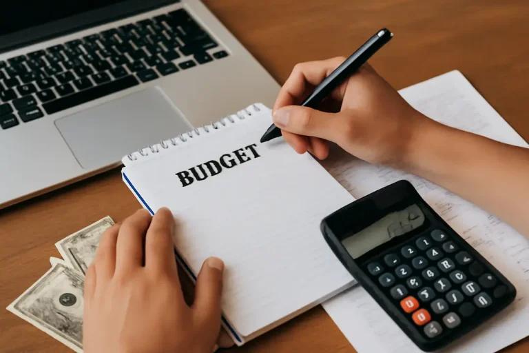
Gomyfinance.com Create Budget: A Simple Guide to Managing Your Money Effectively

What is Blogsternation — A Detailed Guide for Bloggers & Creators